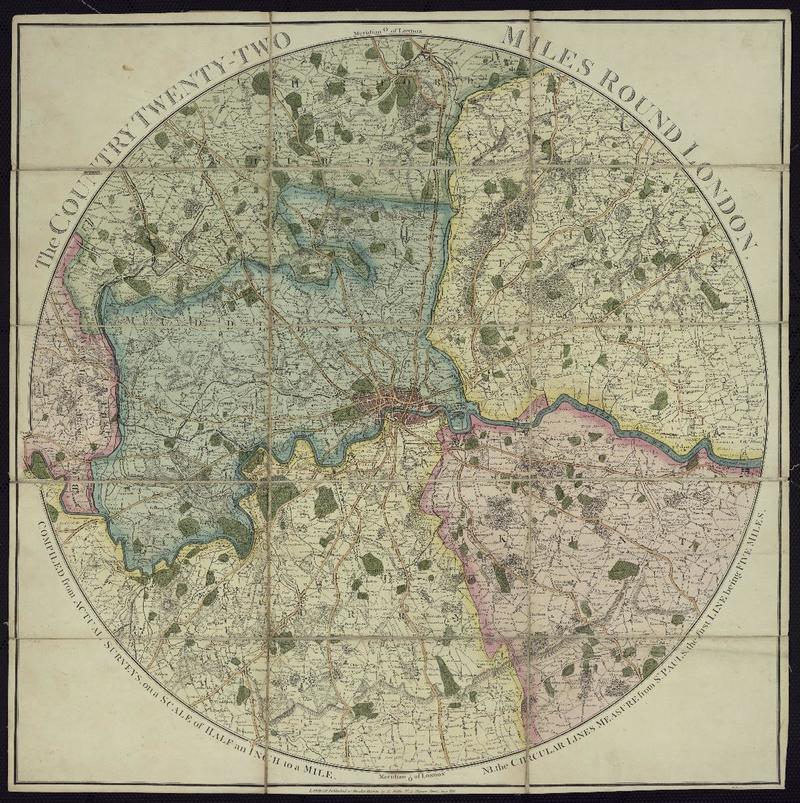
The country twenty two miles around london compiled from actual surveys, on a scale of half an inch the mile. [material cartográfico]

Descripción Física
1 mapa : col.; 60 x 60 cm.
Notas
General
NB. the circular lines measure from st. Paul's, the first line being five miles.
Forma física adicional disponible
Disponible en formato digital.
Reproducción
Reproducción electrónica. Santiago, Chile : Biblioteca Nacional de Chile, Laboratorio Digital, 2022. Objeto digital: MP0007036
Términos de uso y reproducción
Acceso en línea (dominio público) sin restricción de reproducción.
Referencia Bibliográfica
The country twenty two miles around london compiled from actual surveys, on a scale of half an inch the mile. [material cartográfico] London : Published as the act directs by E. Wallis, [1880?] 1 mapa : col.; 60 x 60 cm. .
Clasificaciones
Colección: Mapoteca / Colección General
Materias: Londres (Inglaterra) - Mapas - Vistas aéreas
Género: Mapas
Tipo de objeto: Material cartográfico
Año: 1880
Datos de publicación: London : Published as the act directs by E. Wallis, [1880?]
Tipo de acceso: Acceso en línea
BN Código: MP0007036
N° Sistema: 1012600
BND id: 651077
Londres en Memoria Chilena