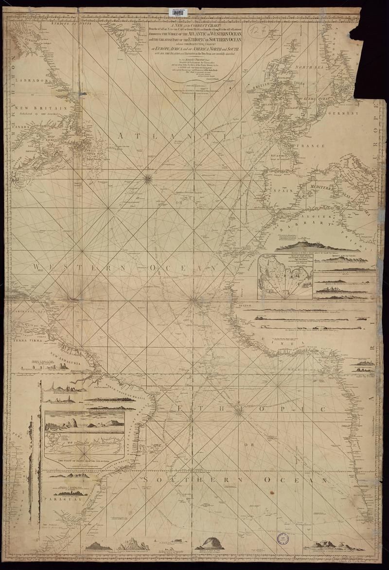
A new and correct chart... : exhibiting the whole of the Atlantic or Western Ocean ... [material cartográfico] : to Sir Robert Preston.

Descripción Física
1 mapa ; 142 x 104 cm. sobre pliego de 145 x 106 cm.
Notas
General
Inserto: mapas e ilustraciones.
Forma física adicional disponible
Disponible en formato digital.
Reproducción
Reproducción electrónica. Santiago, Chile : Biblioteca Nacional de Chile, Laboratorio Digital, 2022. Objeto digital: MP0007011
Términos de uso y reproducción
Acceso en línea (dominio público) sin restricción de reproducción.
Referencia Bibliográfica
A new and correct chart... : exhibiting the whole of the Atlantic or Western Ocean ... / [material cartográfico] : to Sir Robert Preston. London : Laurie & Whittle, 1802. 1 mapa ; 142 x 104 cm. sobre pliego de 145 x 106 cm. .
Clasificaciones
Autor: Preston, Robert
Colección: Mapoteca / Colección General
Materias: Cartas náuticas
Tipo de objeto: Material cartográfico
Año: 1802
Datos de publicación: London : Laurie & Whittle, 1802.
Tipo de acceso: Acceso en línea
BN Código: MP0007011
N° Sistema: 552762
BND id: 650932