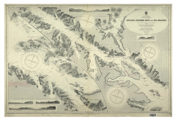
English, Crooked, Long and Sea Reaches South America, Magellan Strait[material cartográfico] : surveyed by captain W. J. L. Wharton and the officers of H.M.S. "Sylvia", 1883.


Descripción Física
1 mapa : blanco y negro ; 68 x 103 cm.
Notas
General
Incluye notas manuscritas
En extremo inferior: Small corrections -- Timbre que dice: corregida hasta abr. 14 1919 Of. de Hidogr. y Nav. -- Large corrections: Octr. 1897, May 1906 -- Engraved by Davies & Company.
Contenido formateado
Vistas de: Long Reach from off Cormorant Inlet -- Desolation Island.
Forma física adicional disponible
Disponible en formato digital.
Reproducción
Reproducción electrónica. Santiago, Chile : Biblioteca Nacional de Chile, Laboratorio Digital, 2015. Objeto digital: MP0001685
Términos de uso y reproducción
Acceso en línea (dominio público) sin restricción de reproducción.
Referencia Bibliográfica
English, Crooked, Long and Sea Reaches South America, Magellan Strait/ [material cartográfico] : surveyed by captain W. J. L. Wharton and the officers of H.M.S. "Sylvia", 1883. London : Published at the Admiralty, 20th November 1884. [London] : [Published at the Admiralty], May 1906. 1 mapa : blanco y negro ; 68 x 103 cm. .
Clasificaciones
Autor: Wharton, William James Lloyd, 1843-1905
Colección: Mapoteca / Colección General
Materias: Cartas náuticas
Tipo de objeto: Material cartográfico
Año: 1906
Datos de publicación: London : Published at the Admiralty, 20th November 1884. [London] : [Published at the Admiralty], May 1906.
Tipo de acceso: Acceso en línea
BN Código: MP0001685
N° Sistema: 960531
BND id: 157391